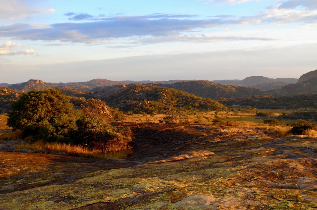
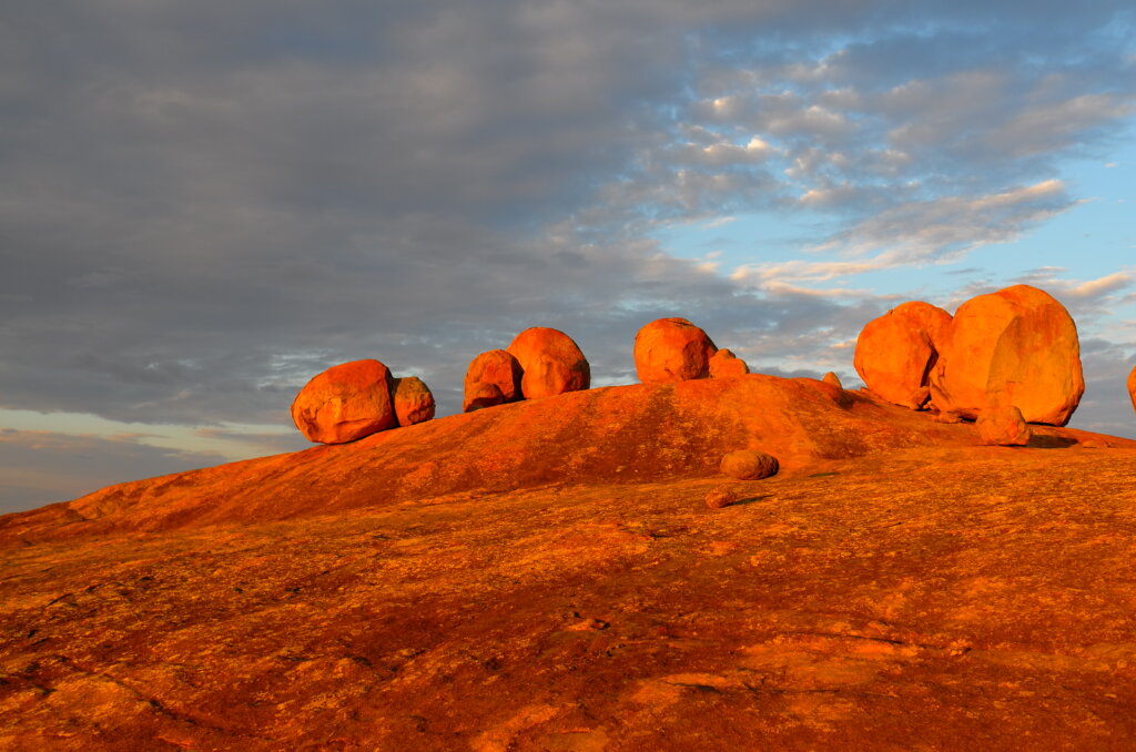
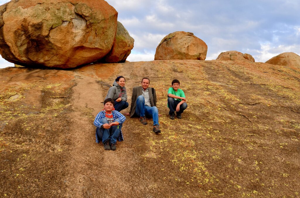
The Matobo hills, which sit high over Matabeleland, near Bulawayo, are a Place of Power. A barren plateau with boulders piled up like giant marbles in an unlikely state of equilibrium. The N’debele believe that the world started in the Matobos and consider this area the most sacred in the land. They may visit but have to leave by nightfall, when the spirits are abroad.
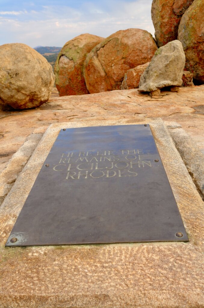
Cecil Rhodes, the founder of Southern Rhodesia, elected to be buried here with his two closest companions, Jameson and Coghlan. Rhodes’ (and his companions’) grave is a simple metal plate, as if he did not want to disturb the serenity and spirituality of the Matobos.
When we visit, in the late afternoon, we are alone on the hill and can feel the silent power and intensity of the Matobos. As the sun begins to set, the giant boulders are illuminated by a bright orange light, as if the lights had suddenly been turned on.
Matobo hillsand then they turned on the lightsgrave of Cecil Rhodes
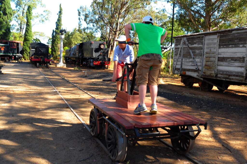
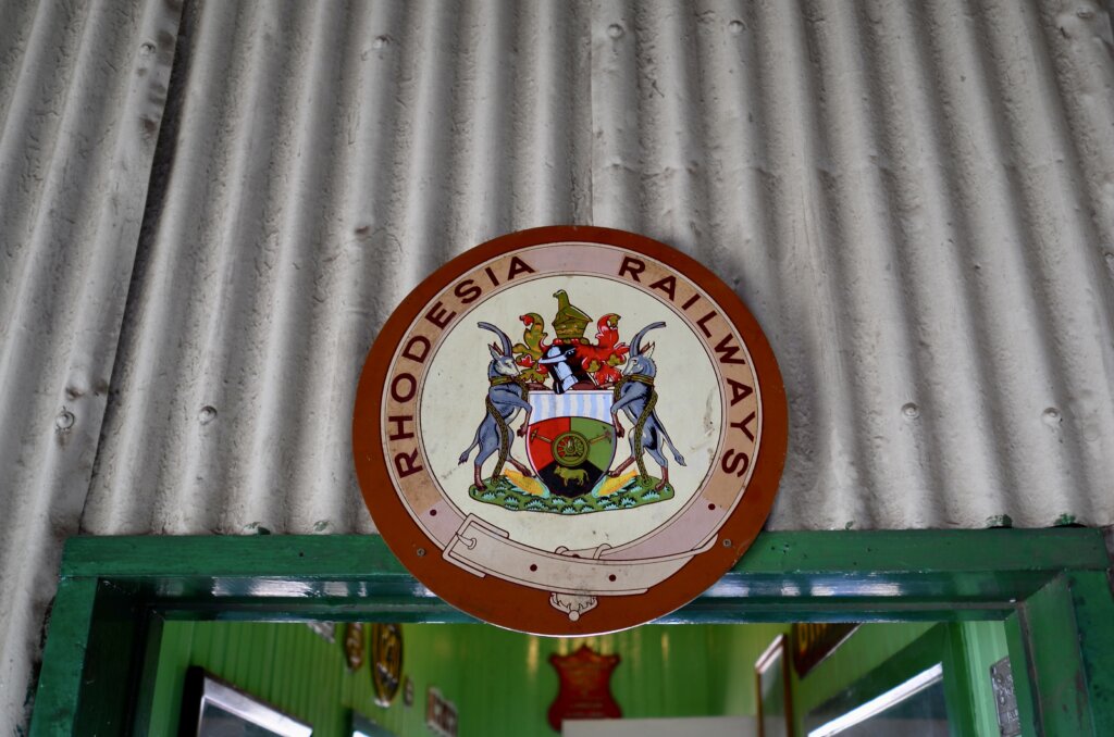
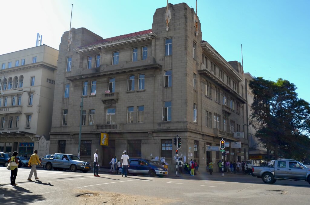
Bulawayo was Southern Rhodesia’s first capital, founded in 1897. A charming, slightly run down town full of colonial buildings, bungalows with overgrown gardens and a relaxed, laid back atmosphere. In its heyday, Bulawayo Station was known to have the world’s longest railway platform…and to keep adding a few feet every time its record was broken !
going places at the Bulawayo Railway museumbefore there was a Zimbabwe…
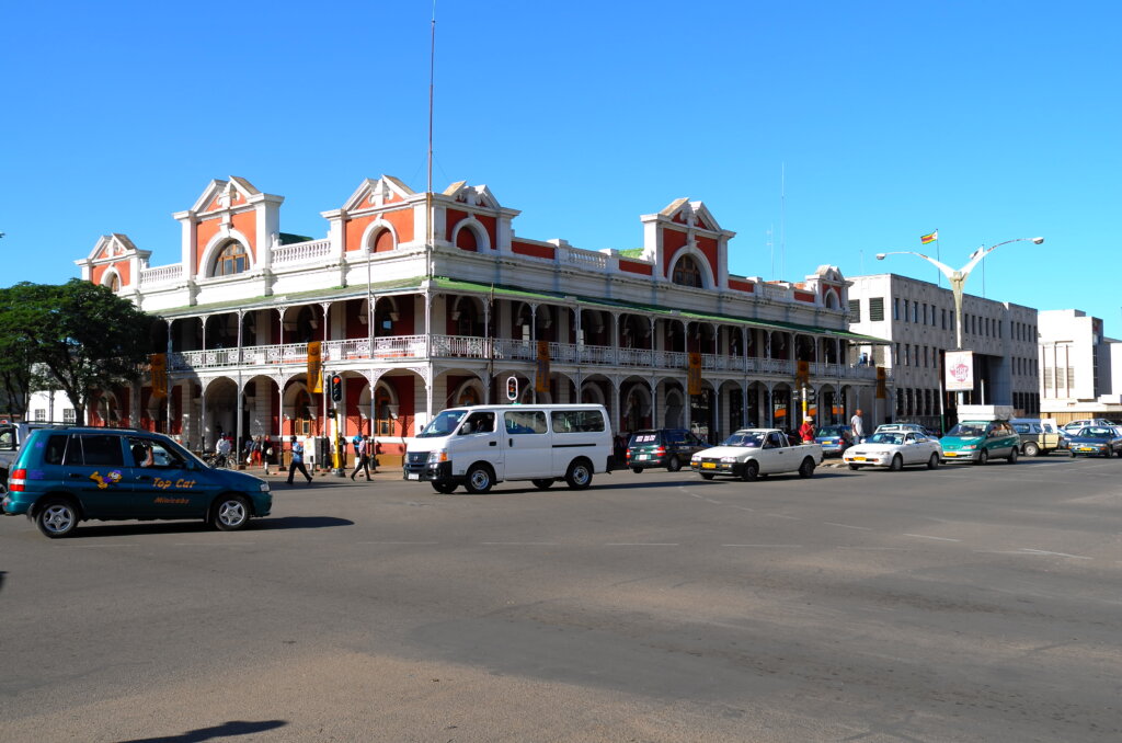
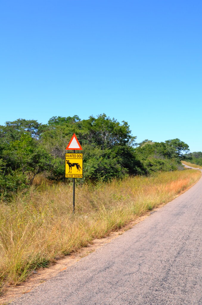
Bulawayo is the present day capital of Matabeleland, home to the N’debele tribe, descendants of a breakaway Zulu faction which migrated here in the 19th century. The N’debele were at the losing end of a power struggle with the dominant Shona after Independence in the 1980’s and the government has essentially abandoned Bulawayo for the past 30 years.
streets of Bulawayo
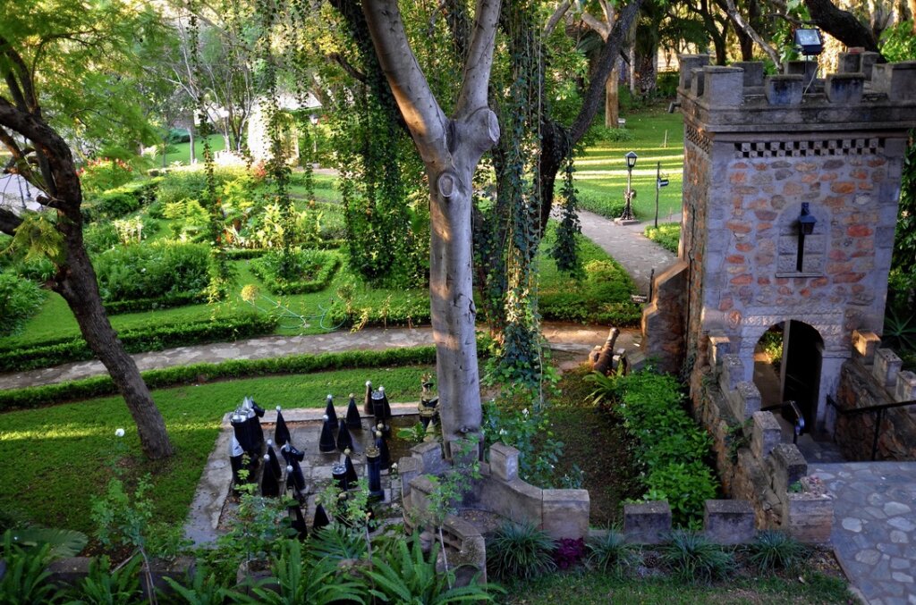
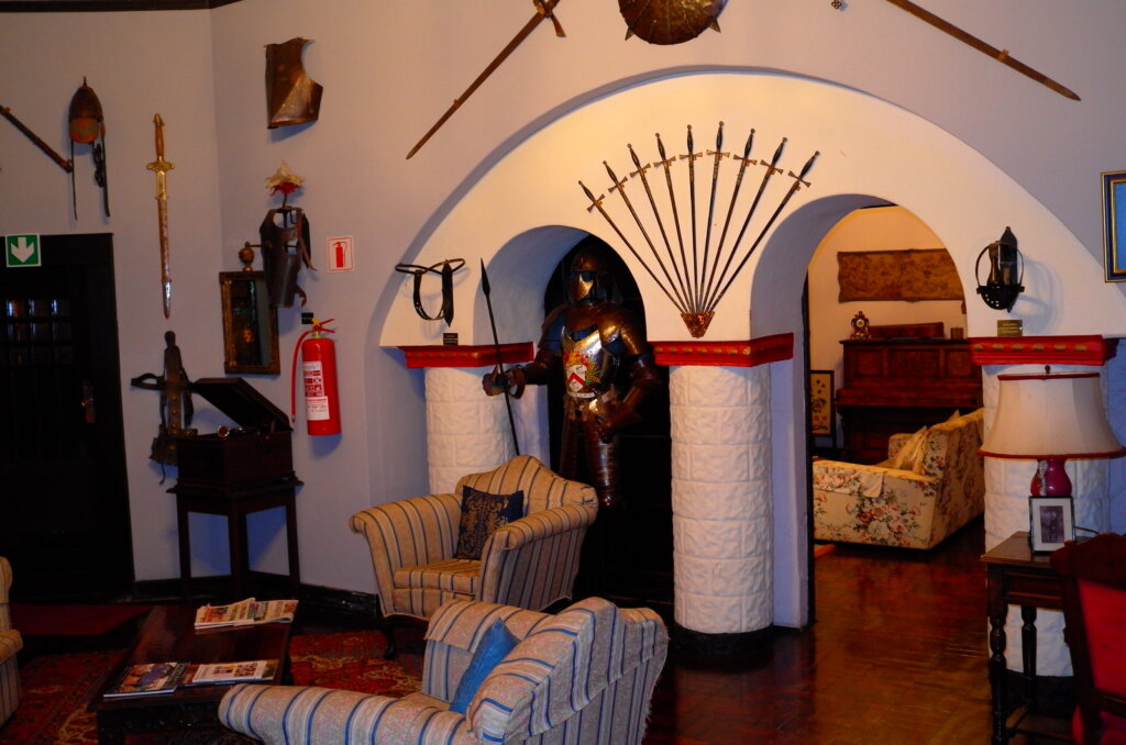
We stay at the Nesbitt Castle, an anachronistic medieval castle built by an eccentric Rhodesian in the 1920’s, full of hidden nooks and crannies, crenellated turrets and secret passages.
With hardly a modern building in town, Bulawayo has a languid, slightly decrepit colonial air to it. It’s an easy town to like and we promised ourselves to visit again.
Nesbitt Castle – view from our roomlounge of the Nesbitt Castle
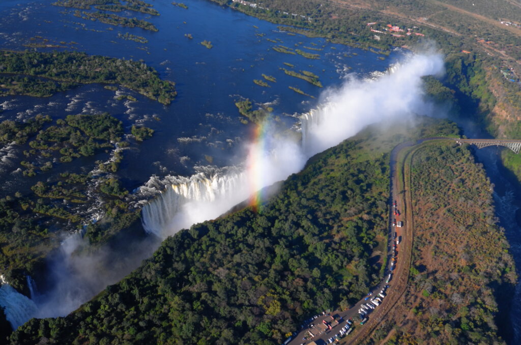
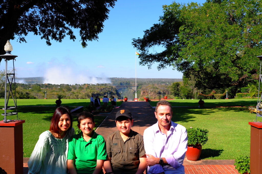
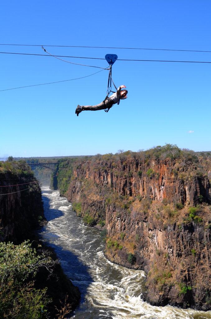
The “smoke that thunders” is what the Victoria Falls were called by the native inhabitants before David Livingstone “discovered” them and renamed them.
One hears the Victoria Falls before one sees them. And from miles around, one can see the gigantic clouds of spray which are propelled upward by the falls and form a permanent vaporous canopy over the town.
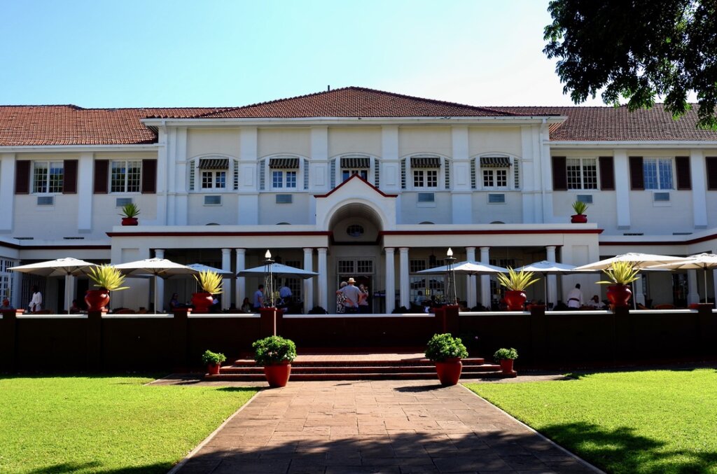
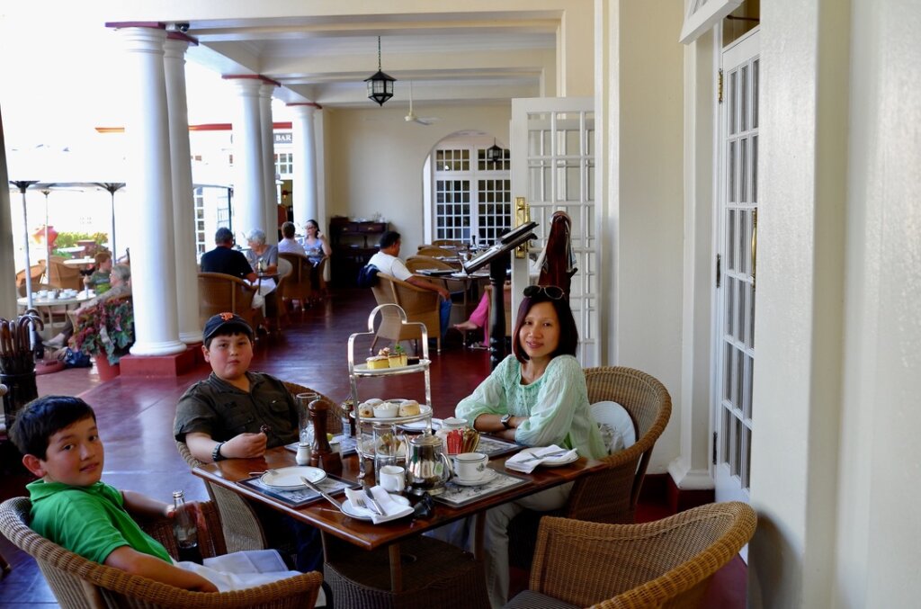
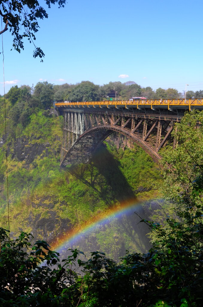
The small town of Victoria Falls owes its existence to the megalomaniacal dreams of Cecil Rhodes to build a Cape to Cairo railroad which would never have to leave British controlled territory on its journey through Africa. Rhodes wanted his railroad to impress and amaze. What better way to accomplish this than by having the train pass close enough to the Victoria Falls for passengers to “feel the spray from the Falls”. In 1902, the railway reached the Victoria Falls and construction of a bridge straddling the gorge over the Zambezi river began. The bridge was opened in 1905 as was that grande dame of African hotels, the Victoria Falls hotel where travelers on Rhodes’ train could stop for a sundowner or a proper high tea.
Unfortunately, Cecil Rhodes died two years before the completion of his bridge, as did his dream of a Cape to Cairo railroad. But trains still chug along the railway to this day, crossing Rhodes’ bridge which connects the towns of Victoria Falls in Zimbabwe to Livingstone in Zambia on the other side of the Zambezi.
Victoria Falls hotelhigh tea on the terracespray from the falls in the backgroundthe bridge seen from the Zambian side120m above the falls
Namibia’s strange geography is the legacy of bizarre 19th century colonial politics. A 550km long finger of land (about 30km wide) sticks out of Namibia from its north-eastern corner and pokes out in a straight west to east line through Angola, Botswana and Zambia before its tip reaches Zimbabwe. The tip of the finger at its westernmost point is where the borders of four countries meet on tiny Impalila Island: Namibia, Botswana, Zambia and Zimbabwe.
The Caprivi Strip, named after Count Leo von Caprivi, the German foreign minister at the time, was ceded to German South West Africa so that it would have an access to the Zambezi river and, from there it was hoped, to German East Africa, through the Portuguese and British colonies which surrounded it. Today, it is a part of Namibia which does not quite fit. After driving past the veterinary barrier north of Grootfontein, and 100km south of Rundu where the Caprivi Strip begins, Namibia sort of stops and traditional Africa begins.
The pretty Cape Dutch and German neo-gothic houses are replaced by villages with traditional huts surrounded by thorn hedges. The large ring-fenced commercial farms give way to communal land with cattle roaming freely on the roads. Heavily laden ladies walk by the roadside carrying firewood or groceries on their heads. The ubiquitous yellow water container which we had not seen for months reappears. And, unlike in the rest of Namibia where all the “rivers” are in effect just dry riverbeds, here the rivers actually have water!
Real water in the rivers! Stopping in Divundu on the Caprivi Strip.
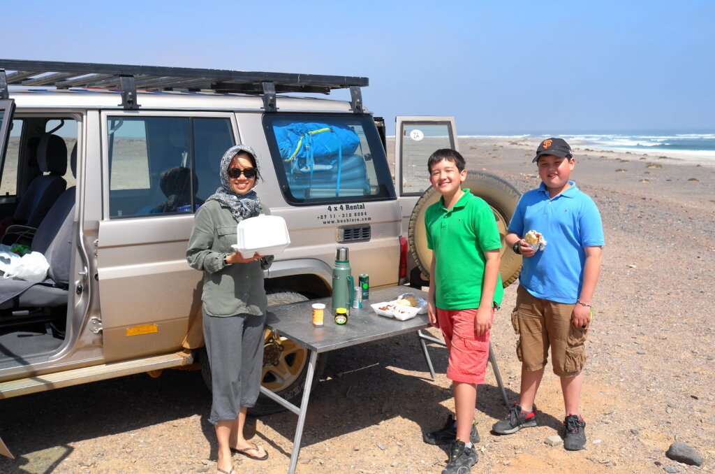
After a stop en route in Divundu on the Caprivi Strip, on 30th April, we drive the last 300km of the strip, travel a further 200km through three countries (Namibia, Botswana and Zimbabwe) and finally reach Victoria Falls in Zimbabwe, having crossed two borders within a day.
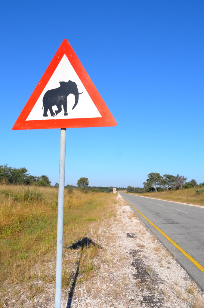
Border post with a view: Okavango river seen from the Botswana border post.driving through Chobe in Botswana, which is home to the world’s largest elephant herd
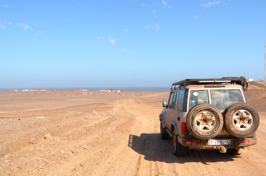
By the time we park our car at Vic Falls, we have driven close to 10,000km through southern Africa, had six tyre punctures, dealt with quite a few (mostly polite and friendly) border officials and had a couple of close cuts on treacherous Namibian roads.
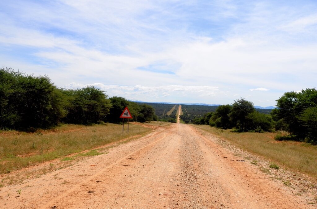
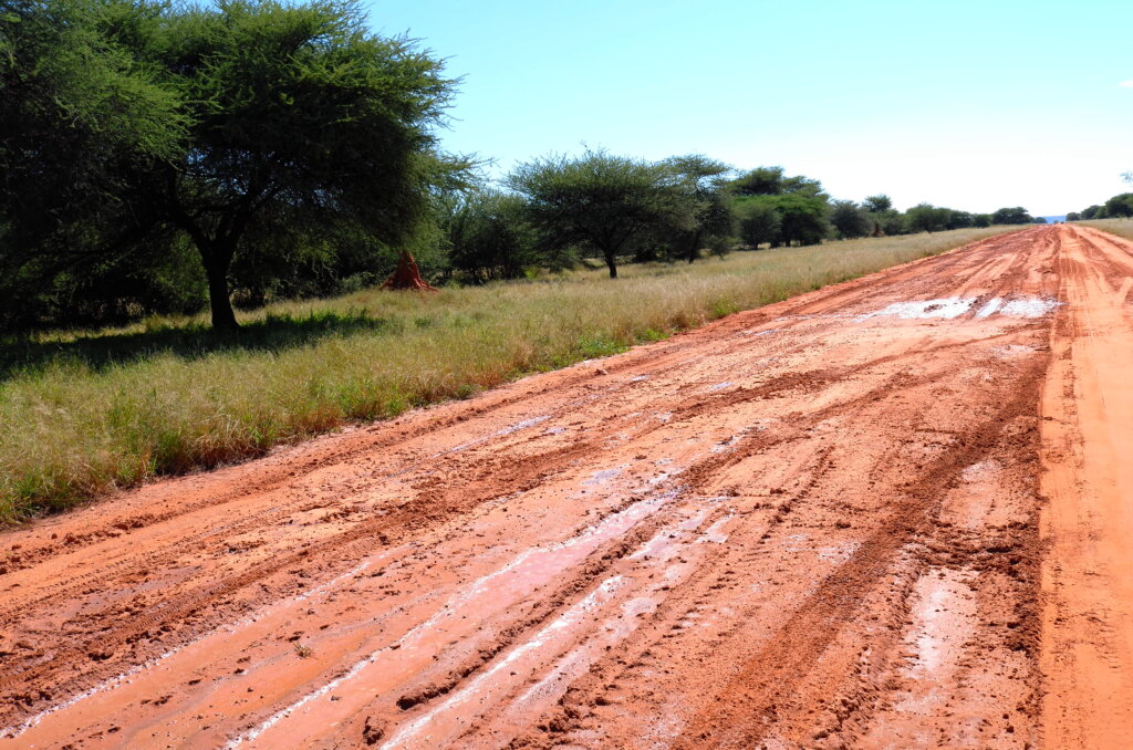
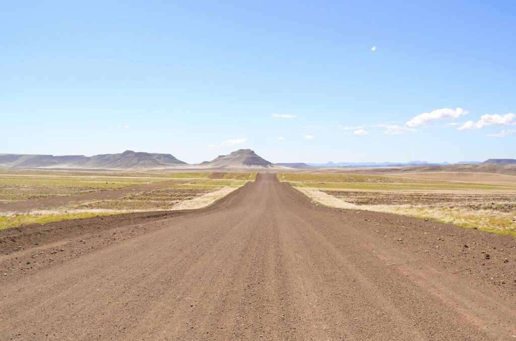
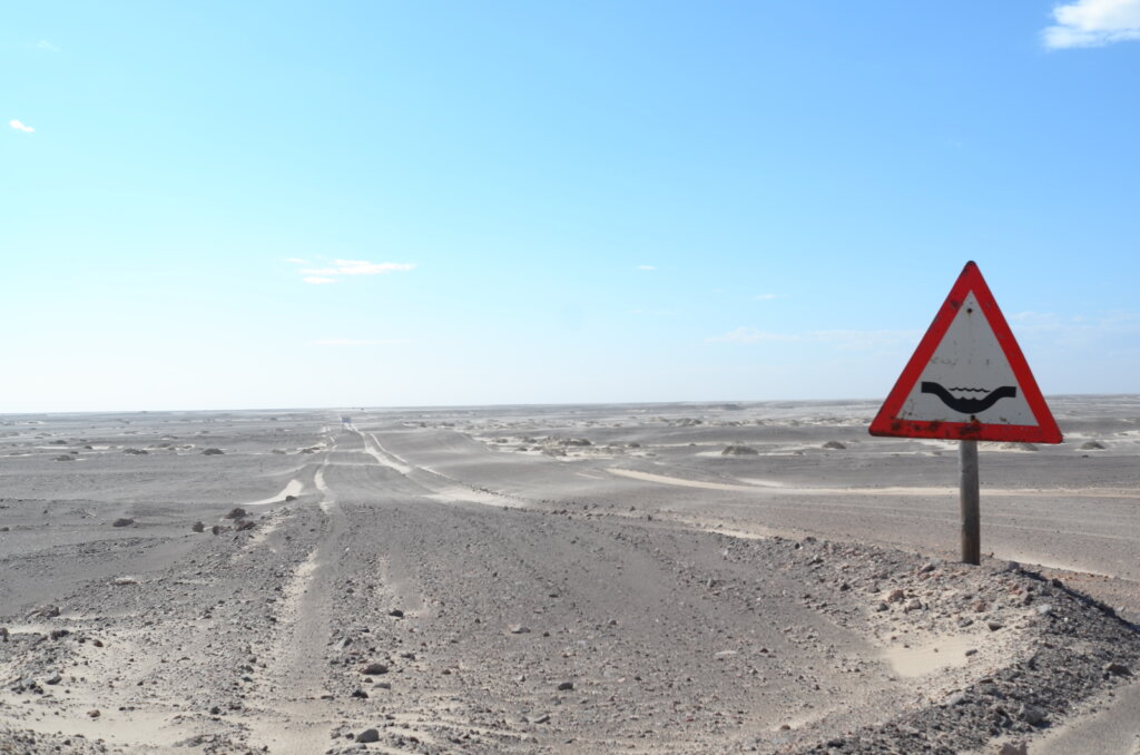
Namibian roads reflect the environment which they travel through. Mostly gravel, dirt roads, dry river beds and, on the coast, a strange mixture of salt and gravel.
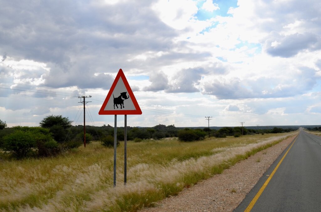
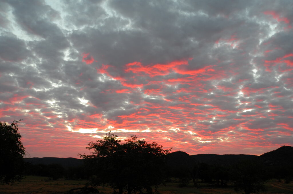
typical Namibian gravel road……which instantly turns to mud when it rainscutting through the Namibian dreamscapethe consequences of gravel roadsDry river bed. The actual river runs a few feet under the sand.very occasionally, we come across asphalt, but we have to be careful to dodge the warthogsBut when the sky lights up at dusk, the roads no longer matter
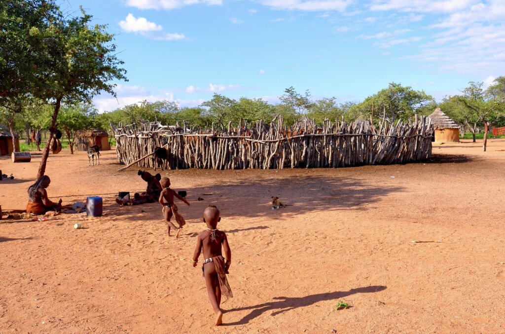
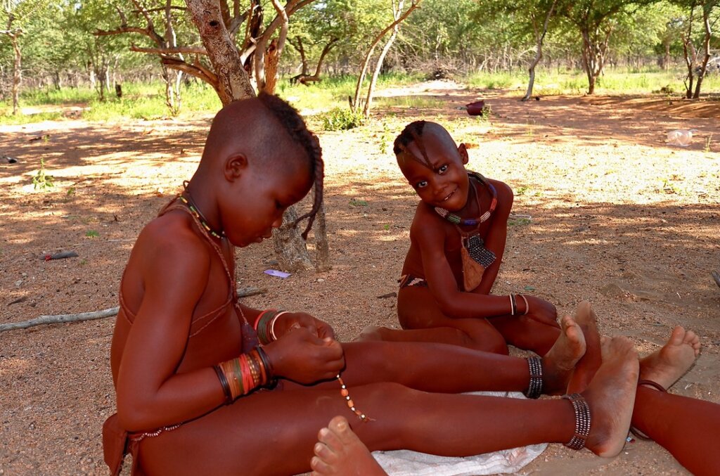
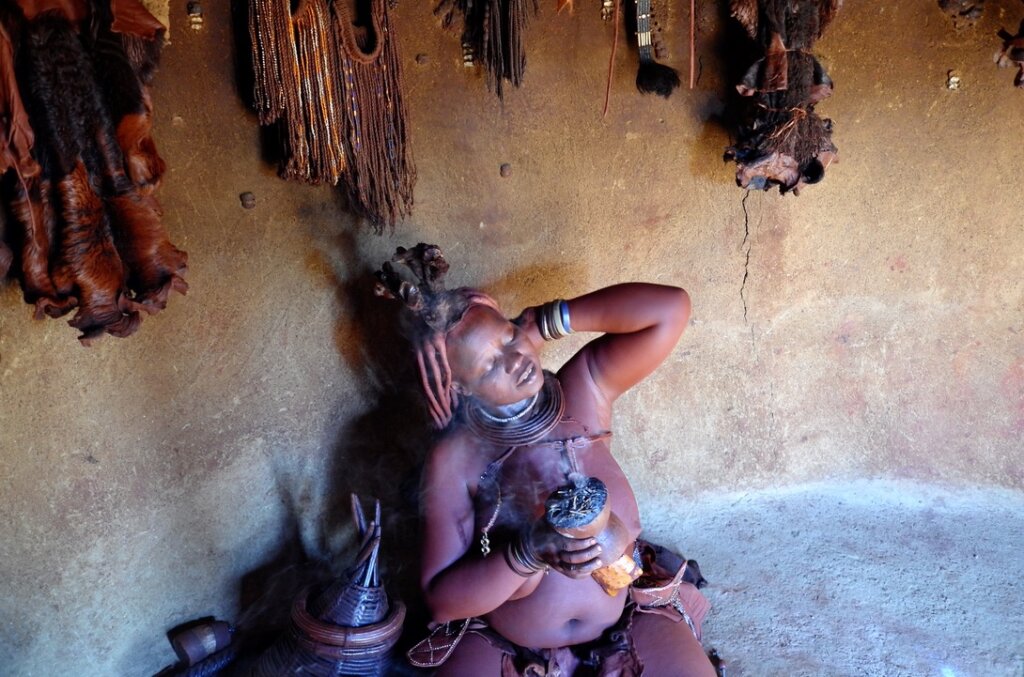
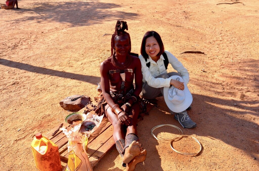
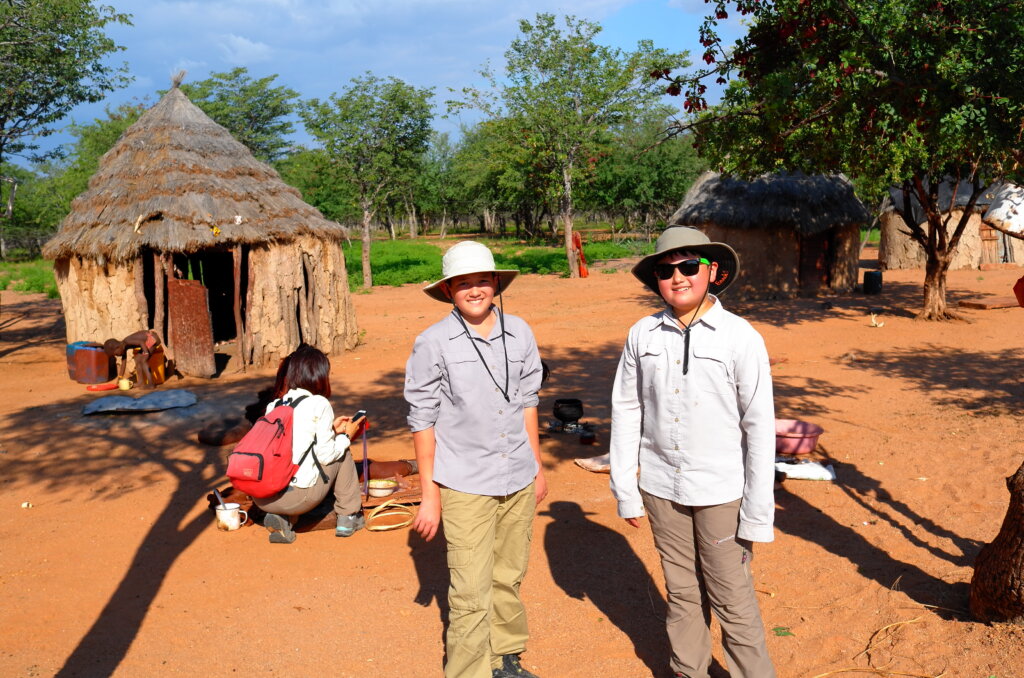
The Himba are one of Nambia’s last remaining “primitive” tribes. They live in the Kaokoland region of Northern Namibia, near the Angolan border. A semi-nomadic tribe distinguished by the bright orange paste, a blend of ochre and butter, which they apply to their bodies and hair. The Himba live in small mobile settlements organized around a central kraal where they keep their cattle.
The Himba are one of the few tribes in the world who have adopted a bilateral descent system, which means that a child is a member of both her father’s and her mother’s clans. This is advantageous as it allows her to rely on two sets of families rather than a single family.
In the harsh semi-arid environment where they live, Himba custom decrees that only men are allowed to use water to wash. Women, once they reach puberty, may only wash by smoking themselves with a mixture of aromatic herbs and may never again use water.
One interesting fact about the Himbas is their perception of colour. The Himba language only counts four words to describe colour:
Zuzu: dark shades of green, blue, red, purple ;Vapa: white and yellow ; Buru: some shades of green and blue; Dambu: other shades of green, red and brown.
As a result, the Himba have great difficulty in distinguishing between the colours within a grouping. Evidence to support the fact that language determines the way we think and perceive the world.
central kraalthe clay necklace around her neck will be broken once she marriesbeadingwashing with aromatic smokea chat with the doyennethe shadows are getting longer
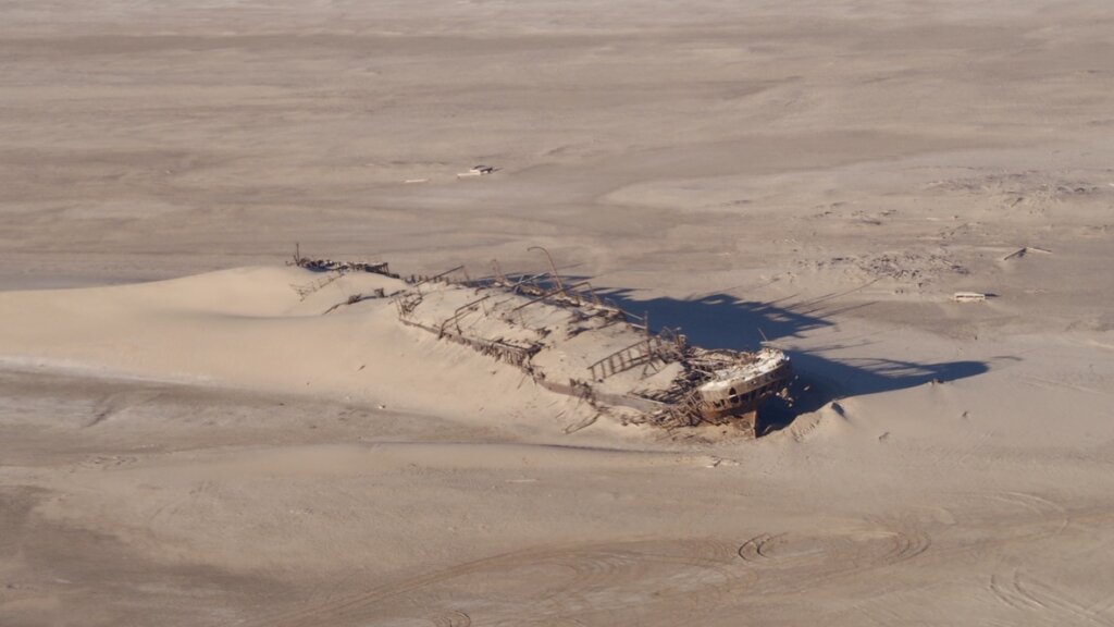
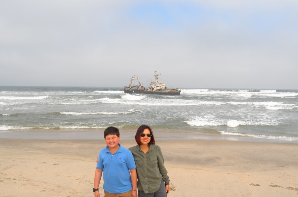
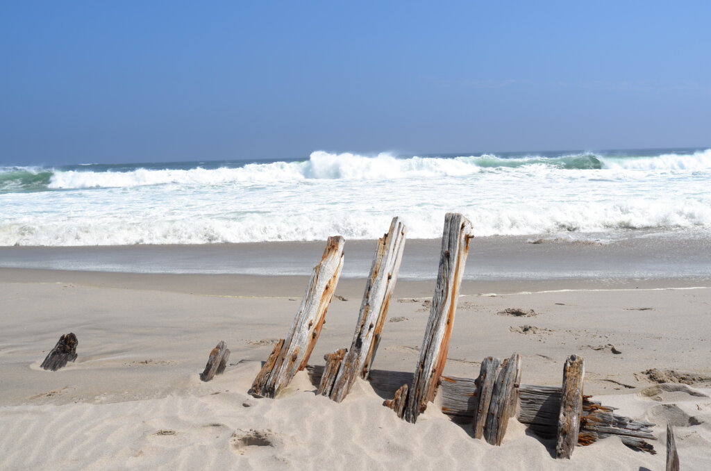
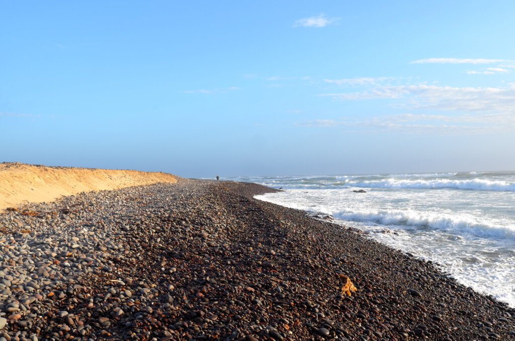
It is a 380km drive up the Skeleton Coast on a desolate road hugging the Atlantic coastline to Terrace Bay which, literally, is at the End of the Road. Covered in fog most of the time, the Skeleton Coast is a graveyard of ships, littered with hundreds of shipwrecks and the remains of sailors who lost their way in the fog and got stranded on the coast. There is no “soft landing” from the icy Atlantic to the Namib desert. The waves lap the feet of the high sand dunes and for two hundred kilometers inland, there is no tree, plant or water. The sailors who survived drowning and made it to the shore had no chance of survival.
As we drive up the Skeleton Coast through fields of pale orange dunes, plains of sand so white it looks like snow and craggy hills, out of the corner of our eyes, we catch fleeting glances of the ghosts of sailors of old, wandering aimlessly along the shore. Every time we stop at a shipwreck, we get the eerie feeling of clammy hands on our shoulders.
Terrace Bay is a tiny settlement with a few rental bungalows and a permanent population of less than 20. It is the End of the World.
road to the end of the worldEduard Bohlen, sank 1909Zeila, stranded since 2008South West Seal, sank 1976only the ghosts of the shipwrecked to keep us company on the Skeleton CoastThe End of the Road: Terrace Bay in viewbetween the desert and the deep blue sea (at Terrace Bay)the sun sets over the settlement of Terrace Bay
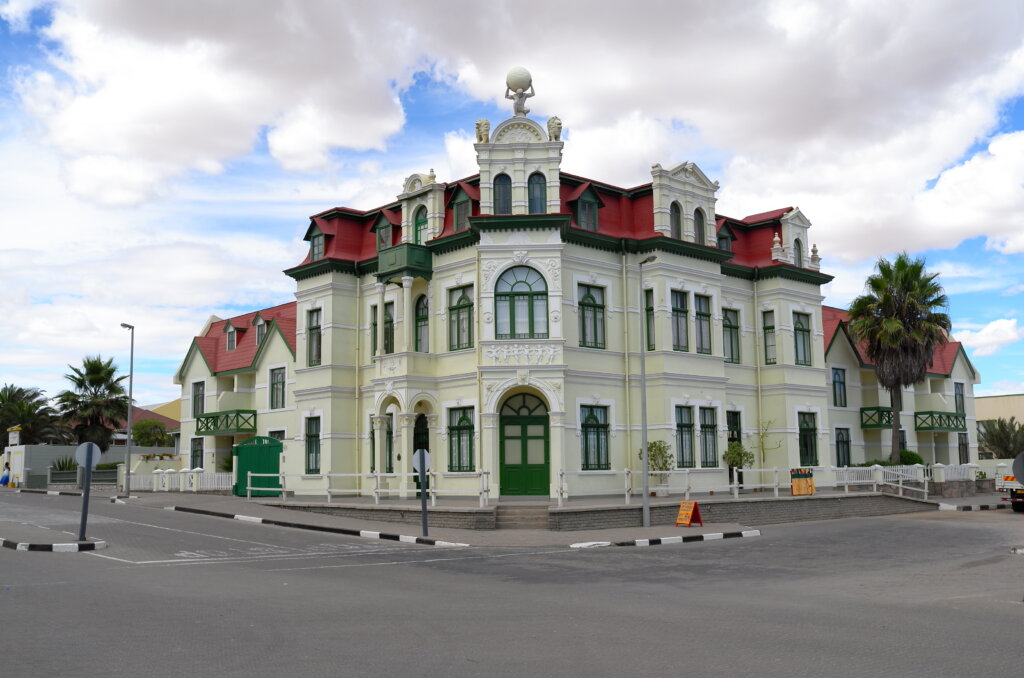
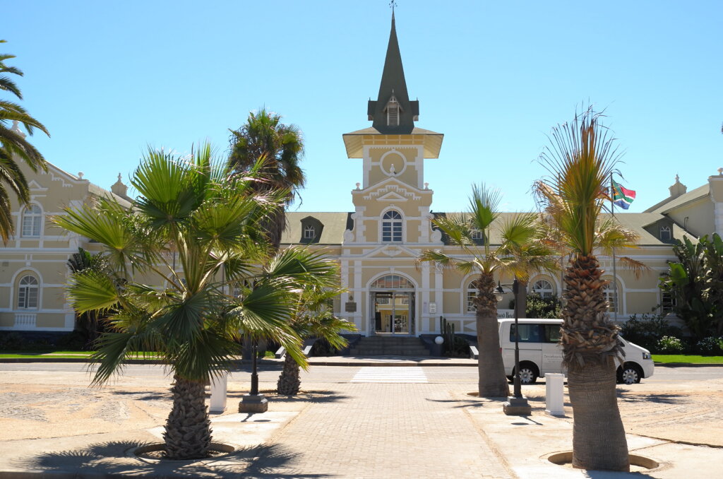
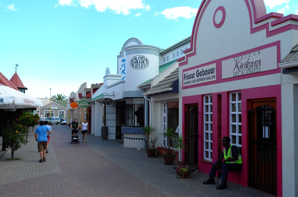
Swakopmund is another charming old German town on the Atlantic “skeleton coast”, grander than Luderitz, surrounded by desert and ship wrecks slowly sinking into the sands of the Namib. Elderly German couples stroll in the boulevards and greet us politely in High German or stop to ask whether they can help with directions. They don’t make towns like that in Germany anymore! Which may explain why Swakopmund could be mistaken for a retirement home for Germans.
This is our last stop in civilization before we head back to the desert and the bush for the next two weeks and we take the opportunity to stock up, enjoy some air conditioning and window shop in the quaint boutiques. We even visit the only two Chinese restaurants in town. From tomorrow onwards, it’s back to kudu, impala, oryx, blue wildebeest and similar delicacies!
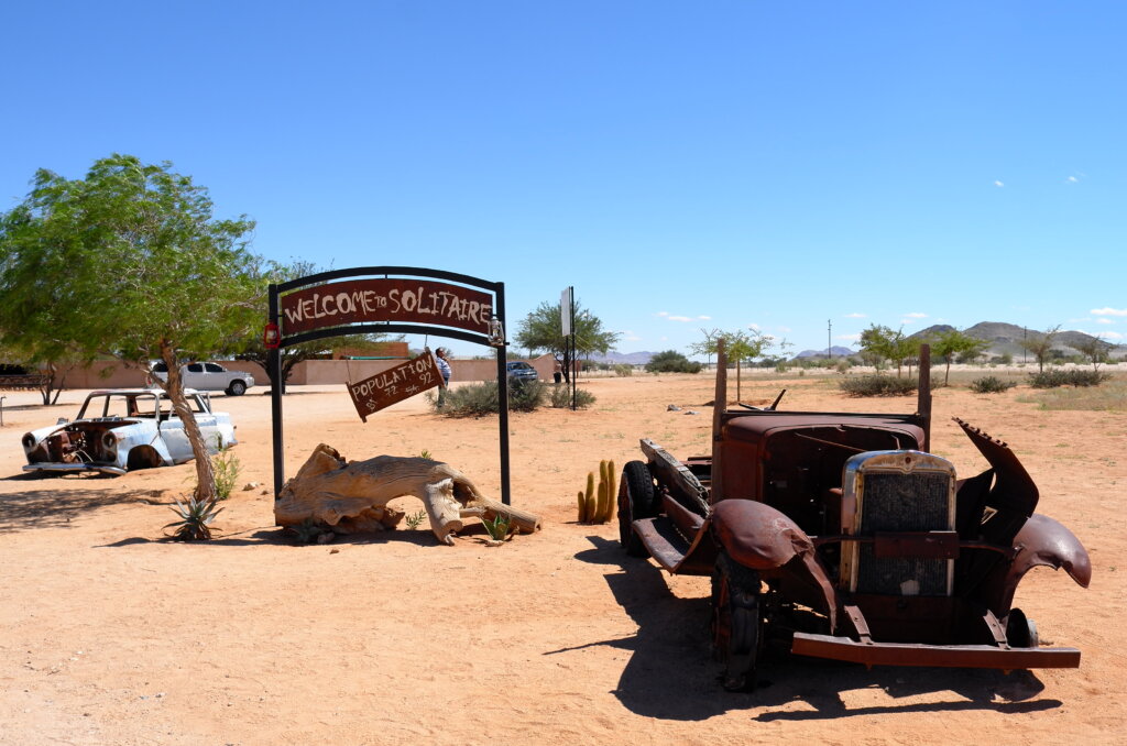
stopover at Solitaire on the way to SwakopGermanic architecture, transplanted in the middle of the Namibold German Imperial Railways buildingbusy street in Swakopdune blasting just outside of town
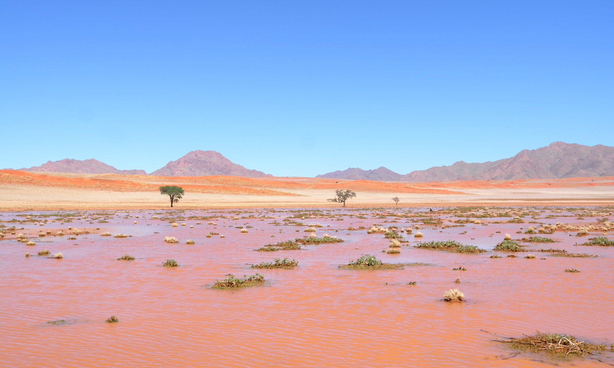
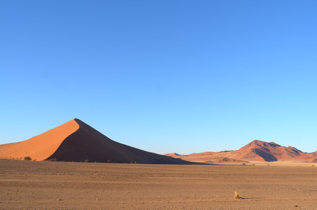
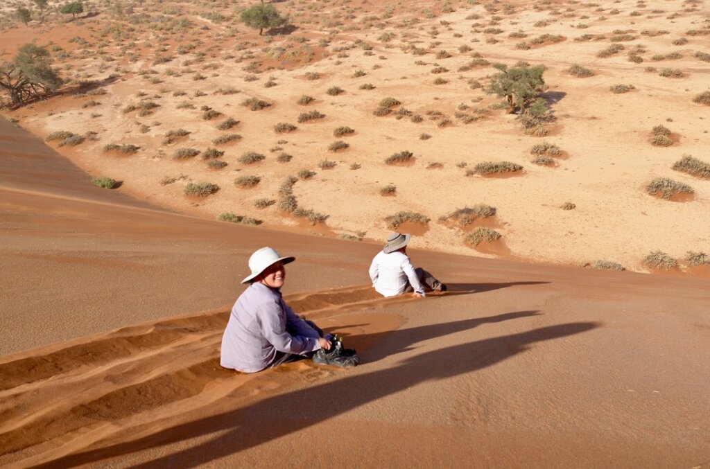
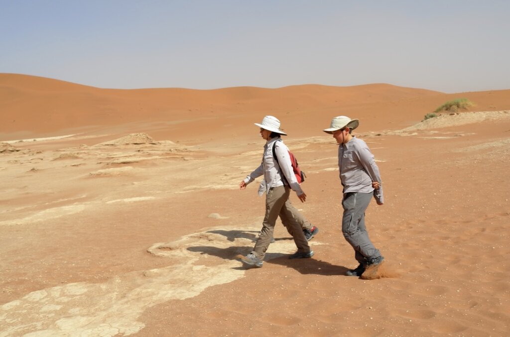
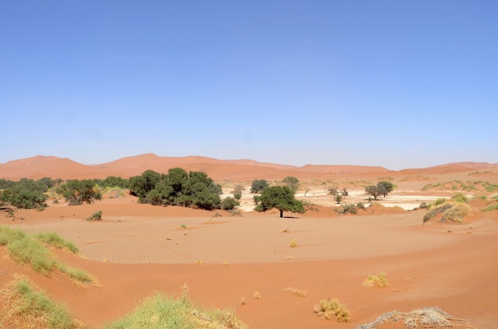
In another part of the Namib, we travel through a field of tall red sand dunes that light up against the deep blue sky, to reach Sossusvlei. A mixed Afrikaans and Nama word meaning “the dead-end marsh”, Sossusvlei is a shallow marshy patch, the only remnant of a long-dead river. It is a remote and atmospheric spot. We almost get lost in a sudden sandstorm trying to reach it.
strangely geometric dunesthe summit at lastfastest way downlost in the NamibSossusvlei, the last remnants of a once fertile land